
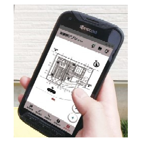
GeoWeb System × GeoWeb LD
Reduce site survey work by up to 161 minutes! An easy-to-use layout creation app that anyone can use to create beautiful layout diagrams.
The "GeoWeb System × GeoWeb LD" is an application for creating layout diagrams aimed at ground surveyors, allowing anyone to easily create layout diagrams with simple operations and reducing ground survey work by up to 161 minutes. The most time-consuming layout diagrams can be created in as little as 5 minutes. By replacing the leveling instrument with the GeoWeb porter II, layout diagrams are automatically generated while performing level measurements, completing the administrative tasks after the survey on-site. By simply measuring location information, it enables automatic drawing of height differences, measurement positions, and neighboring land height differences, preventing calculation errors. 【Features】 ■ High-precision positioning methods allow for height difference calculations and measurement position drawings just by measuring location information. ■ Automatic creation of layout diagrams while performing level measurements. ■ Automatic drawing of measurement points and neighboring land height differences through benchmark measurements. ■ Input of neighboring land information and setting of elevation correction values are possible. *For more details, please download the PDF or feel free to contact us.
- Company:ジオサイン
- Price:Other
